January 18th, 2020
Miles: 14.2 including approach trail
Temperatures: Daytime highs of 50s, down to 30 overnight
“What pack did you take on the PCT?” I ask far too intensely. Rafael squints in the artificial light, with “what bro?” written across his face. It’s 4am, and we’re in Jared and Johanna’s Dallas living room where we’ve crashed for the night having stayed up late, no surprise, talking gear. No need to continue the conversation at this exact moment… One of the founders of Texas UL, Rafael arrived with Riddle from Austin last night. But instigator-in-chief of this particular adventure – a massive winter group hike of the Eagle Rock Loop – is Romy, who picked me up not-so-on-her way from Houston yesterday. It’s a Big Bend/ Texas UL team reunion and we are no longer randos.
I’ve been convinced to leave my inner net tent behind again despite my massive tick-phobia (you can always trust ultralight friends to talk you out of carrying your fears), and now we are headed to the trail about 4 hours from Dallas. I’m strangely excited we are passing through Texarkana, there’s something about border portmanteau town names that amuses me greatly (Texoma, Calexico…and oh yes, Latex on the TX/LA border). We’re starting at the lesser frequented Lower/ South Athens Big Fork trailhead though, and the final instruction are complicated warnings against which road to take instead of where to actually go. One way is gated, another washed out. Everything finally makes sense when we realized the directions are written from a Nashville perspective.
Yes, Nashville. This is an uber-meetup between ULTexas and ULSouthEast, and somehow it was posted on the general UL Reddit site and people are joining us from as far as Alabama and Illinois to traipse around the winter woods, 20 of us from 7 states all together. We are students and retirees, thru-hikers and noobs and dreamers. For John, a local, this will be his 16th lap of this circuit, while its my first time in Arkansas. Our numbers include several Reddit-famous gear-makers, and rumor has it, Ultralight Jerk himself (who is polite, quiet and generous in person). Is this a good idea? We’re about to find out.
Somehow our car is the last to arrive at the trailhead, where Romy humbly declines requests for a speech and we’re off on the approach trail just before 10am. Single file, the group stretches out on the first hill, sorted by the usual calculus of ability times ego. The first stream crossing comes before we even hit the loop-proper – a sign of things to come. Those with long legs find dry passage, but I chose to sacrifice one shoe instead of taking the risk of an unplanned soaking under the gaze of like 10 dudes I don’t know, half of whom are filming. Shortest one across with dry feet wins and I am not it.
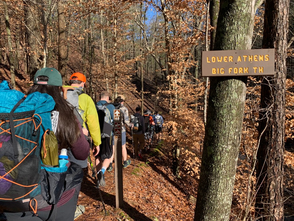

Photo cred: Riddle 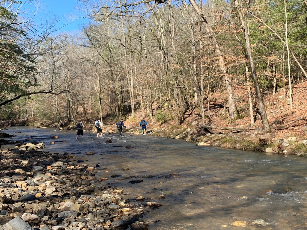
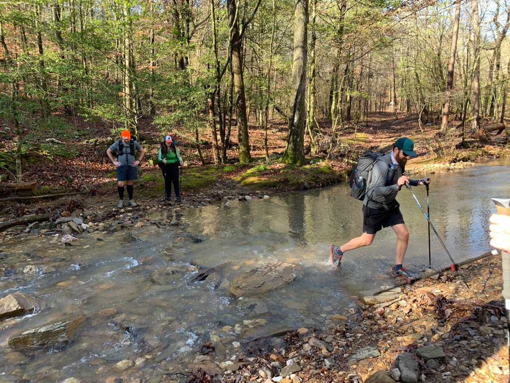
The Eagle Rock Loop is like the Rae Lakes Loop of the Ouachita range: an incredibly popular view-packed circuit that’s easy enough to draw hikers of all kinds of experience and tough enough for bragging rights. Basically, ERL has two modes: straight over ridge after ridge and straight through the water one river crossing after another. The organizers have wisely decided we will tackle the hills on the first day while still fresh, leaving the wettest bits for the way out.
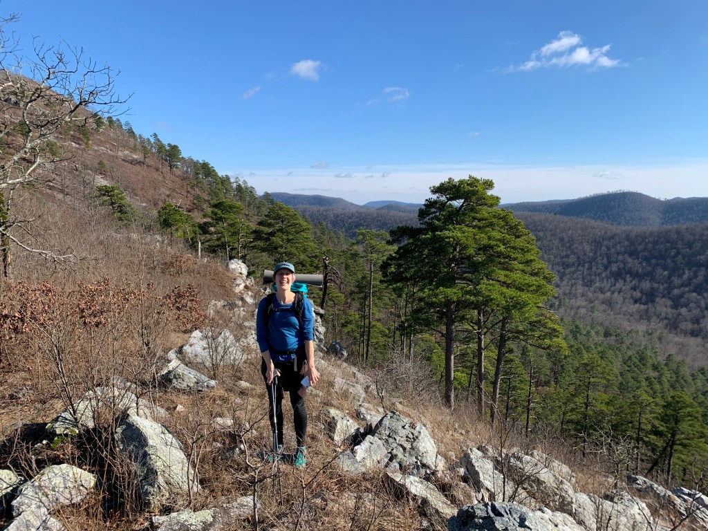
The bulk of the day is a series of seven parallel ridges, all perpendicular to the trail. There are no switchbacks to be found, but it’s really not that bad. Up a few hundred feet, just enough to get the heart working, maybe a view or not at the top. Take the side trails for better vistas when you feel like it (thanks Turner for the tip and the photo!). Then down the other side, steep enough to pay attention and be glad for poles, not enough to really slip. At the bottom, a clear side creek trickling or a larger creek gushing across colorful pebbles or both. Feet wet and head up again. Repeat. Repeat. Repeat.
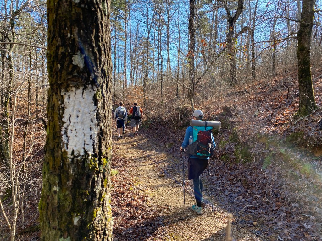
Photo cred: Riddle 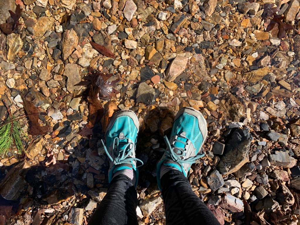

There’s nothing dangerous at all with the water today, never more than knee deep, and warmer than expected (at least compared to snowmelt) but it is still wet. At one crossing a couple of still dry-shoed day hikers pause on the other side, curious to learn the secrets of our confidence: “we’ll watch to see how you do it,” they say, intent faces masking what has to be disappointment as we splash straight through as usual. We laugh our way up the next ridge, assuming they were expecting a more technical demonstration.
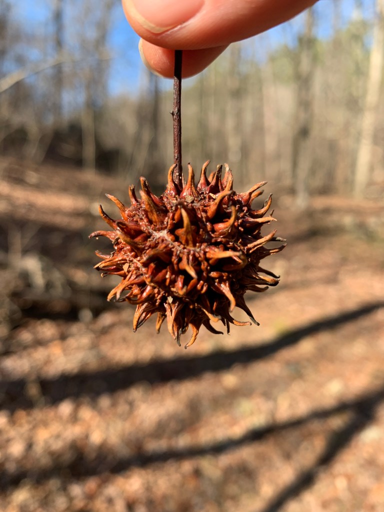
After a few ridges, I settle at my comfort pace, which lands me alone in the middle of the pack. I try to come to terms with the strange naked forest, bright with the diffuse light of low sun. Used to the Pacific Northwest forests that seemingly grow greener as mosses puff up with winter wetness, I’m now facing more shades and textures of brown than I’ve ever seen, with only the odd red or yellow leaf clinging to otherwise bare beaches, a lingering hint of what must be a riot of fall color. This reminds me of the little bit I’ve done of the Georgia Appalachian Trail late fall a few years back, deciduous forest and repeating hills of steepish but well trodden trail. But I don’t know enough about either to untangle what must be finer nuances of vegetation and geology.

Another large group passes headed the opposite direction. “Finally a woman!” exclaims one older lady. I assure her there are more behind me, but as I count in my head, only 5/21 hikers on this trip identify as women. Then I’m back to hiking by myself, more than content to simply be crunching through crispy leaves, hiking actual hills out in the sun. Until the trail seems eerily deserted. I check my phone for confirmation I’m still on track and the GPS is all wonky and refuses to update. I still see blazes, but then side trails are blazed here too. So I pause and sit with my worries (what if I’m lost and 20 people from the internet find out!?!), hoping the others will catch up soon. And they do – I am right on trail. That’s what I get for gleaning all my confidence from my device instead of my head.
As we turn down the Little Missouri River trail, the ridges are all behind us and the tone shifts completely to nearly flat trail winding riverside with the occasional crossing. I blast out some miles at a decent pace, until the light of the setting sun hitting river-side moss stops me in my tracks.

I slow down to chat away the final miles to camp, passing a few sturdy bridges near the Little Missouri Falls day use area, where the air is growing increasingly frigid. I arrive at camp at 5pm. I am relieved to see a rare expansive flat area of forest where the 20-odd of us can spread out without causing any harm to the landscape. Thank you trip planners! We’re not, however, the last to arrive. Carolyn surprises us (we figured she must have camped sooner) after night hiking for two hours ALONE and she’s only done a few trips before. I cannot tell if her cheery energy is adrenaline and relief or if she really wasn’t phased by it at all. Badass either way.
Our camp is a traveling trade show of ultralight everything. All the latest and lightest packs, tarps and tents. The most amazingly colorful (and so warm looking!) homemade puffy jacket. There are tent-less cowboy campers and stubborn winter cold soakers. We huddle in a circle scooping dinner from tiny pots and ziplocks, feet wet or bare or in bread bags, braving the now 38 degree temps chatting away the evening until teeth are doing the most chattering. And off to bed I go already cold, ignoring my own advice to warm up with some jumping jacks. Grasping for warmth in the day’s accomplishments, I drift off to sleep trying to forget that I’m once again using my food as a pillow. In bear country.
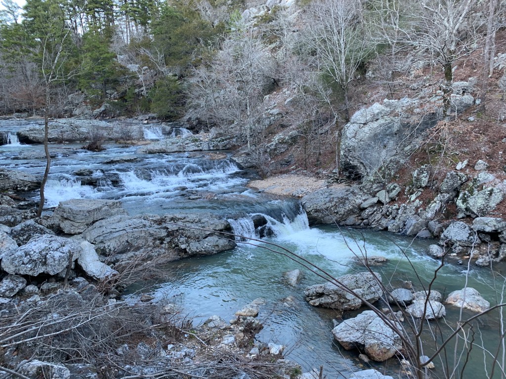

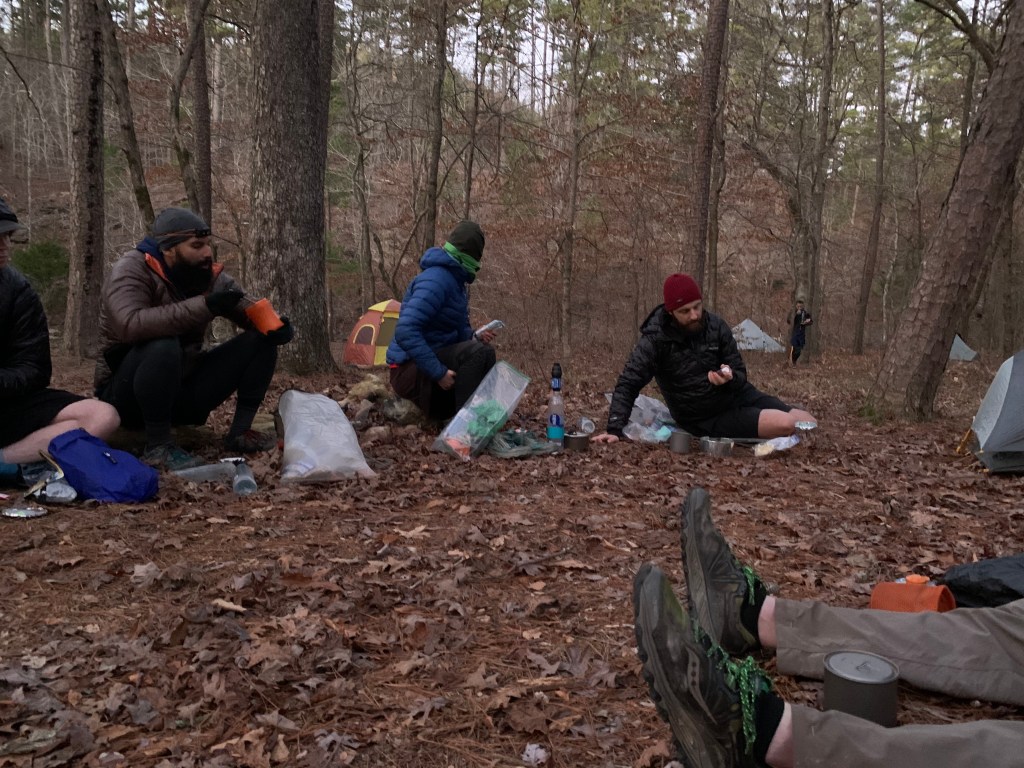
Photo cred: Turner
